 by IntelliMass
BackRoadIntel for First Nations · Territory Intelligence Platform
Their trucks. Your road. Your numbers.
A working brief: how a Nation holds its own record of a road through an industrial project.
Who holds the record of the land after the project? Right now, the proponent does. This page is the practical version of changing that — what gets collected, when, by whom, what the comparison can settle at the end, and what it cannot. It is written for the person who would have to run it.
A pilot is complete with a British Columbia First Nation, with further work under way alongside First Nations and regional districts across the province.
In this brief
When the only record is someone else's.
The proponent builds the access road. Their consultant writes the condition report. Their photographs are the evidence, taken on the days they chose and framed the way they framed them. Two years on, the culvert at the crossing is crushed, the staging ground was never pulled back, and the only thing anybody can point at is a file the other side assembled.
None of that requires bad faith. It is simply what happens when one party documents and the other remembers. A dated record held by the Nation does not make the proponent wrong; it makes the question answerable. The rest of this brief is how you get one.
Do not ask them to pay for it. A record the Nation commissions is the Nation's to produce, or not. A record the proponent commissions is theirs. That independence is the whole value of it at the referrals table, in a negotiation, and on the day a contractor says the road was fine when they left.
The baseline is the only part you cannot collect later.
Everything else in this brief can be started mid-project and still be worth having. The condition of the road before the first loaded truck cannot. If the work has already started, the honest position is that your baseline is "as of today" — which is still far better than nothing, and worth starting this week.
The whole length, in one pass, in a vehicle with the kit in it. On a 19 km access road that is about twenty-five minutes. The road is divided into 200 m segments automatically — roughly 94 of them on that length — and every segment gets a condition reading, a position and a frame of video.
A single pass is a true record of that road on that day and it is evidence the moment it exists. What repeated passes buy is the ability to tell a real change from ordinary scatter. Roughness is sensed through a moving vehicle, so no two passes land identically even on a road that did not move. The smallest change a comparison can resolve falls with the square root of the number of passes — which is why a dozen passes before the trucks is worth far more than one.
Culverts, crossings, bridges, cattle guards, gates, signs, the right-of-way itself, the staging grounds and the reclamation sites. Each becomes a watch — a standing question attached to a place, answered again on every drive that passes it, rather than a note in somebody's inbox.
Practically: if a project is six months out, you have time to build a baseline out of trips that were happening anyway. If it starts next month, drive the route deliberately a handful of times. If it started last year, start now and say plainly what your record does and does not cover.
While the work is going on.
Nobody is hired to go and look. The kit rides in vehicles your people already drive — Guardians, public works, the emergency coordinator, anyone with a reason to be on that road — and the record accrues out of trips that were happening regardless. Capture is driver-started: one action at the beginning of a drive.
The hitch-mounted sensor scores the ride continuously. Every pass lands on the same road axis, so the same 200 m of road lines up across dates and you can watch it move.
Scout sensorDated, geolocated video of the whole way through — ditches, cut slopes, culvert inlets and outlets, fence lines, approaches, cleared right-of-way, staging areas, and what was dumped or left behind. On a project, beside the road is where most of the obligations live.
Dashcam deviceA spoken field report, tapped on the wheel, stamped with where it was said. "They've widened the pull-out past the creek again." Transcribed and catalogued by what it describes. The thing a photograph cannot tell you.
Voice field reportsOne drive returns all three. There is no separate inspection programme to staff, and no month in which somebody forgot to do it.
At closeout, the comparison does the arguing.
When the contractor says the work is done, the record already holds the answer. The comparison runs segment by segment along the road's own line: the window before the trucks against the window after the remediation, the same 200 m against itself.
What comes out is not an opinion about whether the road looks alright. It is a count. How many segments came back to where they started, how many did not, where those sit, and whether they sit together — because a contiguous run of worse segments is what a real local problem looks like, and scattered ones are usually noise. Alongside it sits the thing a community actually feels: how long the drive takes now compared with before.
Minutes, not levels
A roughness level is an internal unit. "A twenty-three minute drive became forty-two, and the remediation gave back all but five minutes" needs no explanation at a table.
Where it did not come back
The segments still reading worse than before the trucks, and whether they form one run. That is the ask: a location, a date range and a direction.
What the comparison could resolve
Every comparison carries the smallest change it could have detected. A movement below that figure is not a finding, however much it looks like one.
What the record settles, and what it does not.
Being clear about this before a project starts is worth more than any feature. A record that is oversold once is not trusted again.
It settles what the road was like, and when. A dated, located condition reading and a frame of video for any point on the route, on any day it was driven. Nobody has to rely on recollection.
It settles the direction and size of a change. The same stretch against itself across windows, with the resolution of the comparison stated alongside it.
It settles where to look. The stretches that moved most, so an engineer, a crew or a negotiator spends their time in the right kilometre.
What it did, and what came back.
A hauling season on an access road under an agreement, measured before, during and after. Every reading lands on the same road axis, so the windows stack and the same stretch lines up down the page. The road was fine in March, the loaded trucks doubled its roughness by May, and the remediation took most of that back out — except in one place. None of it was a measurement campaign, and none of it was commissioned by the proponent: it is drives the Nation was making anyway, on a road the Nation was already using.
The same segments, where they actually are. The haul reddens the whole line; the remediation takes it back to green — except at the creek crossing, where it does not. Each chip is the average speed over that 8 km stretch and the minutes it adds against before the trucks — the 2 km detail runs under each strip below.
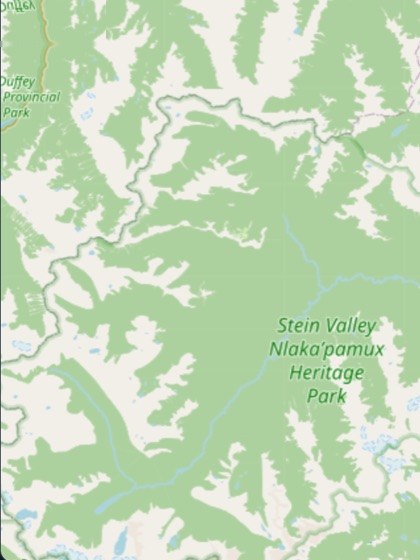
Basemap © OpenStreetMap contributors. The road line and its condition readings are constructed for this example; in the platform these are live maps that pan and zoom together.
Read across the windows: the road was in good shape before the trucks, roughness p90 5. Under haul it reached 9; by the time the trucks stopped it was 10 — double where it began. The remediation brought almost all of it back — except the creek crossing: one continuous 1.2 km run from km 10.6 to 11.8, and the only stretch anywhere on the road still reading worse than it did in March. That is the tell for a problem that is not a surface problem: water, or what is under the road. In minutes — the lane under each strip — a 23-minute drive became 42 under the worst of it, and still runs 28 after the repair: five minutes added to every trip anybody makes, each way. The rest was restoration the contractor owed; that one is a drainage repair, and now you can show why.
Illustrative — the shape of a real comparison, with constructed readings. The score is comparative: the same road against itself, window to window, so a stretch that degrades is visible. It is not calibrated, not a profilograph, and not a pavement condition index; an engineer's measurement is still an engineer's measurement.
What running this actually costs you.
Not money — effort. The money question is at the bottom of the page and the answer is "ask us". This is the part people underestimate in both directions.
The kit goes in a truck that was already driving the route. No crew, no survey window, no scheduling against anybody's availability.
The driver starts capture at the beginning of the trip. Field reports are optional and take a tap and a sentence. There is no form.
This is the real cost. One person who knows which routes matter, which assets are under agreement, and who looks at the record when a watch fires. A few hours a month, not a role.
The failure mode is not technical. It is a kit that lives in a vehicle nobody drives on the route that matters, or a record nobody opens until the week of the dispute.
The community holds the record.
The record of a project on the territory is the Nation's. It is collected by the Nation's own people, on the Nation's own drives, and held under the Nation's own control — OCAP®-aligned in how it is handled: ownership, control, access and possession stay with the community. OCAP® is a registered trademark of the First Nations Information Governance Centre, and there is no such thing as OCAP certification; we do not claim one.
No proponent, ministry or neighbouring authority sees a project record because they asked us. They see it because the Nation decided they should.
The platform can run on infrastructure the Nation controls. That is a real deployment we sell, not a compliance badge — and it is the difference between policy and architecture.
A regional district, a wildfire agency or a utility may want what the Nation has already collected on these roads. The Nation decides whether that happens, on what terms, and gets paid for it.
Pays for itself on the first claim.
Priced to the size of the territory, or per project. A line item Council can approve from the Nation's own revenue — with no proponent in the room and no grant cycle in the way. One restoration obligation met because there was a dated baseline to measure it against is usually the whole year.
Funding help is available for this kind of work and we prepare most of the materials with your team — see the funding section on the First Nations page.
Start with the route you would argue about.
The project will end. The road will still be there, and so will the question of what state it was left in. The only thing that decides that argument is whether somebody was holding a dated record of the land — and whether that somebody was you. Tell us which route you would document first.