 by IntelliMass
Territory Intelligence Platform · BackRoadIntel for First Nations
Your territory. Your record. Your evidence.
Your territory's ground truth, held by the community.
Every drive your own people already make returns three layers at once — what the driver saw, what the road did under the wheels, and the video of the whole way through. A permanent record of conditions across your territory — roads and trails, corridors, sites, land — as they change over time. The community holds the record. Not the proponent, not the ministry.
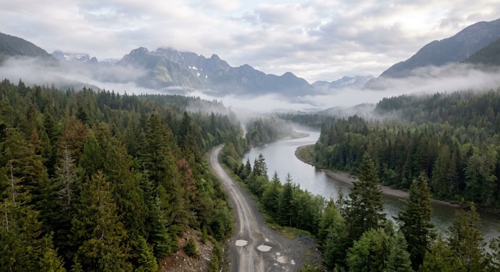
When the only record is someone else’s.
A proponent documents its own work. A ministry documents its own roads. When the condition of a route or a site is in question, whoever holds the dated record holds the argument. Every drive your own people already make can build one that’s yours.
What the record gives you.
Whether the routes out are passable, documented before fire season, not during it.
Roads, corridors and infrastructure covered by impact-benefit or revenue-sharing agreements — verify condition without fielding a crew. When a road under agreement is damaged, the before-condition is on the record, not in someone's recollection.
Roads, trails, sites and land across the whole territory, captured on every drive — what it looked like on that date, not what somebody reported later.
A dated visual record for funders, proponents and government tables, so the ask is documentation, not description.
Whether a site was restored, and when. A dated visual record of reclamation obligations as they come due, held by the Nation rather than filed by the party that owes them.
Condition records for the routes people depend on in high-risk terrain — main roads, back roads and the trails that only your people use — before the season, not during the event.
This is where BackRoadIntel started, active deployments with communities across British Columbia.
The community holds the record.
The record — the video, the sensor readings, the reports — belongs to the community that produced it. Ownership from the first drive, not something you request back later.
The community owns 100% of the data collected in its territory — raw sensor readings, video and reports. It's held in the community's name, and available from the first record.
We reference the First Nations principles of OCAP® — Ownership, Control, Access and Possession. Ownership, Control and Access hold from the first record: the community owns the data, decides who sees it, and can take a complete copy at any time. Possession — the record physically on infrastructure the Nation controls — is the sovereign tier.
Host the record on infrastructure the Nation owns: a cloud account in the Nation's own name, region and keys, or an Indigenous-owned data centre. Sovereignty is something you buy, not a promise about it.
OCAP® is a registered trademark of the First Nations Information Governance Centre (fnigc.ca). There is no OCAP® certification, so nobody — us included — can call themselves OCAP-certified. We align with the principles; the sovereign-hosting upgrade is real work, quoted per deployment.
In the field.
The same record, across the roads, trails and roadside assets you're responsible for, not just the road surface.
One pass. Three layers of feedback.
A drive your people were making anyway comes back as three records of the same moment, locked to the same metre and the same date. Not three programs — one pass, read three ways.
The person at the wheel taps once and says what they see — a washout, a widowmaker over the road, a gate left open. Captured as hazards and action items, located to the metre, in the words of someone who knows the territory.what the driver saw
The hitch-mounted sensor scores the ride continuously — no one has to notice anything or write anything down. Every pass lands on the same road axis, so the same stretch lines up across dates and you can see it move.what the road did under the wheels
Continuous, dated, geolocated video of the route — not the frames somebody chose to photograph. The picture that answers "what did it actually look like on that date", anywhere on the drive.what it looked like
Any one of the three can be argued with. Together they are hard to argue with: the driver's account, an instrument that was not forming an opinion, and the footage — all from the same pass, at the same place, on the same day. That is the difference between a photo album and an evidence file.
The three layers, playing together.
One pass down a forest service road, as it comes back. The route scores itself on the map as the vehicle moves, the video runs beside it, and the driver's notes drop in where they were spoken — turn the sound on and you hear them in his own voice, which is the whole point of the first layer. A real drive, start to finish.
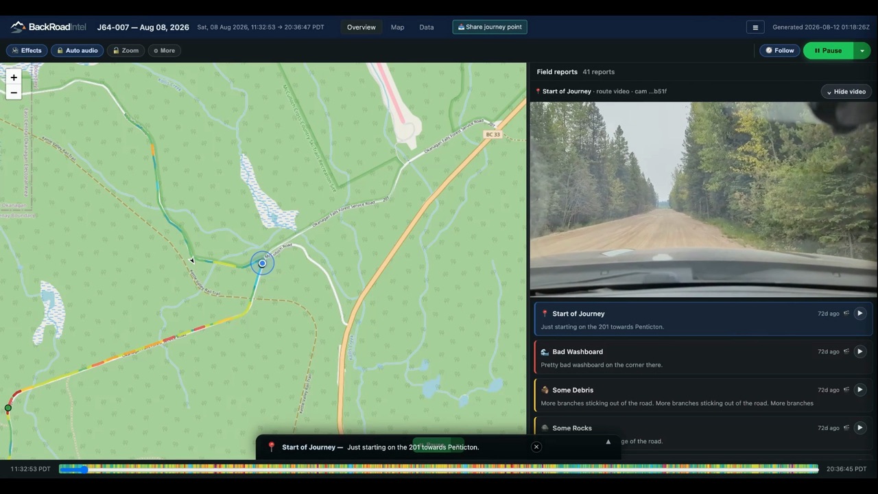 1:06 · real drive · sound on
Not one road. The whole territory, on one map.
Reserve lands, treaty territory, the industrial shared-use zones, the regional assets and the places that keep causing trouble — drawn as zones, with every road through them scored and every field report pinned where it was spoken. A road belongs to a zone; a zone belongs to the Nation. Open any one and you get its drives, its video and its reports.
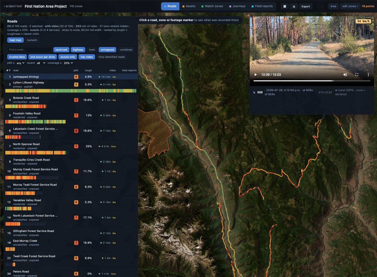
This is the part a proponent cannot hand you and a ministry does not hold: one picture of the whole territory, built from drives the Nation made, sitting under the Nation's own names for the places. It is the difference between answering a question about one road and being able to answer a question about anywhere.
A live project in the platform. Roads are ranked by length × roughness × repeat visits; the strip under each is that road end to end, 250 m a segment. Zones come from the federal survey, keyed by reserve number.
Their trucks. Your road. Your numbers.
A hauling season on a community access road, measured before, during and after. Every reading lands on the same road axis, so the windows stack and the same stretch lines up down the page. The road was fine in March, the loaded trucks doubled its roughness by May, and the remediation took most of that back out — except in one place. None of it was a measurement campaign; it is drives the Nation was making anyway.
The same segments, where they actually are. The haul reddens the whole line; the remediation takes it back to green — except at the creek crossing, where it does not. Each chip is the average speed over that 8 km stretch and the minutes it adds against before the trucks — the 2 km detail runs under each strip below.
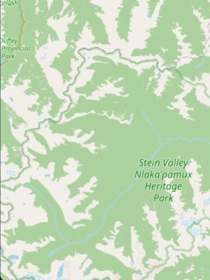
Basemap © OpenStreetMap contributors. The road line and its condition readings are constructed for this example; in the platform these are live maps that pan and zoom together.
Read across the windows: the road was in good shape before the trucks, roughness p90 5. Under haul it reached 9; by the time the trucks stopped it was 10 — double where it began. The remediation brought almost all of it back — except the creek crossing: one continuous 1.2 km run from km 10.6 to 11.8, and the only stretch anywhere on the road still reading worse than it did in March. That is the tell for a problem that is not a surface problem: water, or what is under the road. In minutes — the lane under each strip — a 23-minute drive became 42 under the worst of it, and still runs 28 after the repair: five minutes added to every trip anybody makes, each way. The rest was restoration the contractor owed; that one is a drainage repair, and now you can show why.
Illustrative — the shape of a real comparison, with constructed readings. The score is comparative: the same road against itself, window to window, so a stretch that degrades is visible. It is not calibrated, not a profilograph, and not a pavement condition index; an engineer's measurement is still an engineer's measurement.
The same road, three passes across the season.
Kilometre 4.5 of a community access road, from the same point on each pass, with the weather between them. When someone asks what the road was like before the trucks came through, this is the answer — dated, located, held by the community.
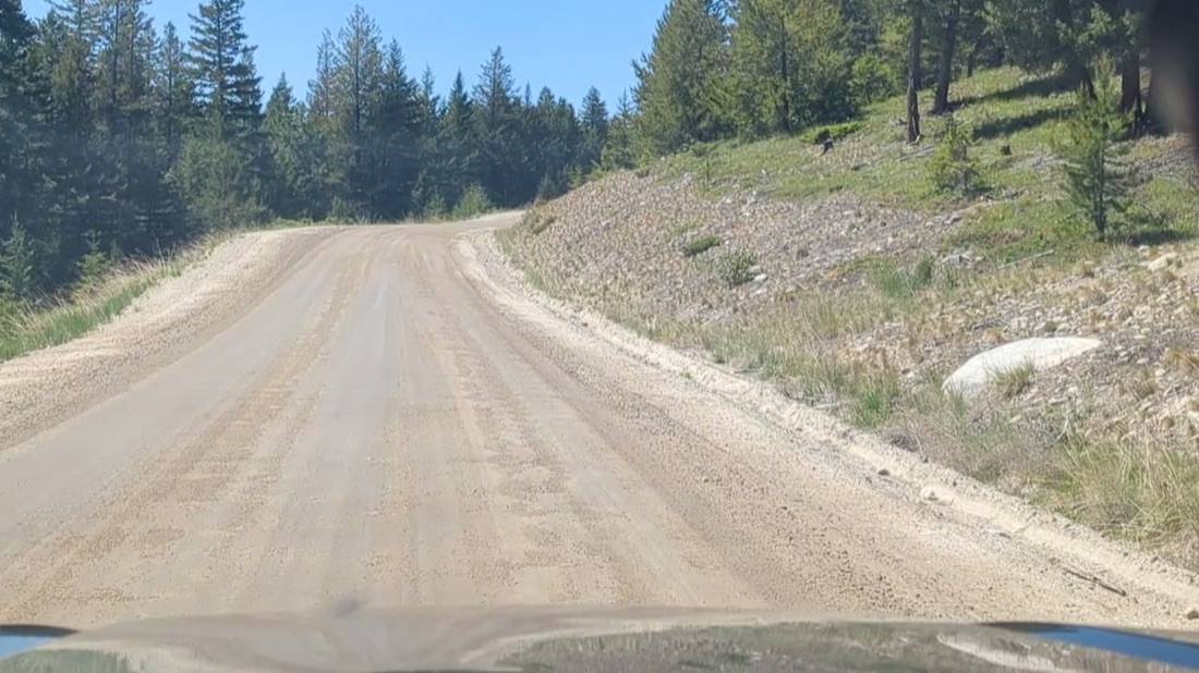
Graded, drains clear, no defects.
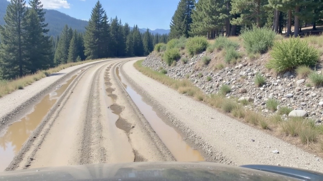
Potholes and runoff in the tracks, shoulder starting to go. Grade it now, before it compounds.
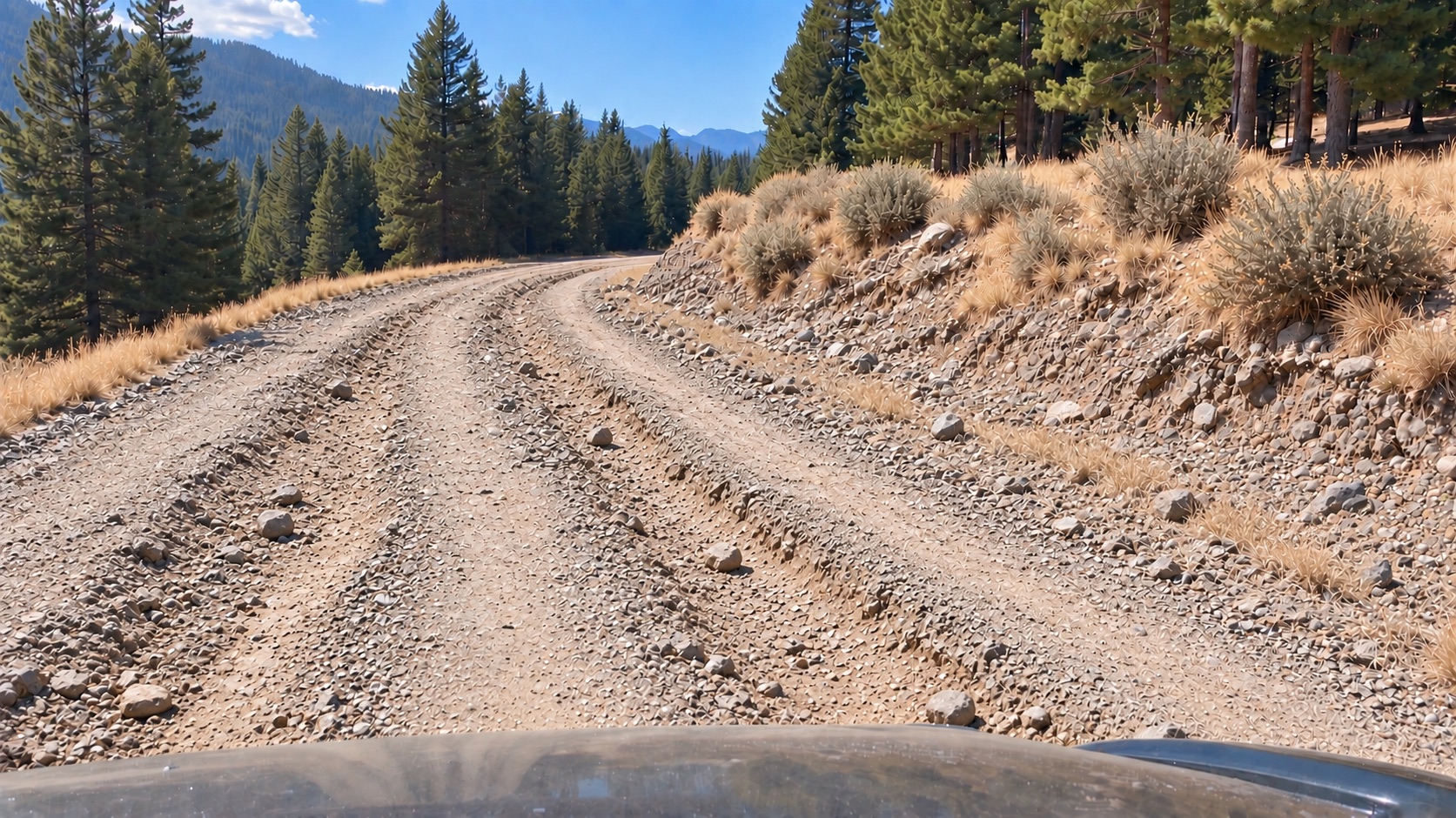
Degraded surface — loose rock, ruts and washboard, many hazards. Now it's a rebuild.
Illustrative prototype. Production records open as hosted, view-only pages on a phone, no login.
Your record, spoken by the people who know the land.
The driver taps once and talks. It is the same device that is recording the video — the Dashcam unit in the kit — so the audio and the footage are one capture. The voice note is saved with the moment it was spoken — the point on the route, the time, the speed, the heading — then transcribed, titled and filed into the record at the place it happened. A form field gives you a category. A voice gives you what the person actually saw.
“There’s a car in the ditch on this road.”
“It looks like smoke coming from the forest area on the right — but I’m not sure.”
“Some rocks that just formed on the road here, we gotta take care of.”
“There’s some equipment in the field on the left that looks out of place. Checking in on it.”
Two of those aren’t certain, and that is deliberate. “I’m not sure” is a legitimate entry. The record keeps the doubt exactly as it was spoken rather than rounding it into a category — and the next pass over that spot is what settles it.
Tap to talk on the Dashcam device — the same unit recording the video. Hands stay on the wheel, and the note is attached to the metre it was spoken at rather than typed up from memory hours later. A photo is tapped the same way.
Every voice note becomes searchable text automatically, so a season of drives is something you can read through and search, not a pile of audio somebody has to sit and listen to.
The transcript is read for what it describes — rock, water, debris, wildlife, a bridge, a washout — and dropped on the map as a titled field report you can filter and pull into a report.
The Dashcam device records the same way on the windshield mount or in somebody's hand. A culvert you stop and walk down to, a slide you get out to look at, a site you cross on foot — spoken, located and filed into the record exactly like the kilometre you drove past.
Because the operator is a community member, what goes into the record is community knowledge — the person who knows that creek floods every spring, the one who remembers what the slope did the last bad year. That knowledge usually lives in somebody’s head and leaves when they do. Spoken into the record, it stays with the Nation.
“Watch this area for rock slides going forward.” Sometimes the driver isn’t reporting today’s condition — they’re asking for the next drive to check something. With the watch option, a spoken note sets a watch from the driver’s seat, named and located as it’s said, then answered on every drive that covers it from then on. No form, no desk, nobody to ask. It is the fastest way a standing question should ever get created — out loud, at the spot, by the person who noticed.
Voice capture, automatic transcription and hazard tagging run in the Scout app and platform today. The four notes above are written as examples — the wording is ours, the format is what a real annotation looks like. Watches, including setting one by voice, are offered as an option on the program.
Set a watch. The record does the noticing.
A field report belongs to the drive it was tapped on. A watch is where a standing question goes instead — attached to a thing or a place, and answered on every drive that covers it. It doesn't have to be the road: a watch can be anything you drive past — a leaning tree, a culvert, a bridge, a gate, a slope, a site somebody has promised to restore.
A watched asset
A culvert, a bridge, a slide-prone slope, a gate. Named, located, and reported on every time a drive covers it.
A watched zone
A stretch of route where a kind of problem keeps happening — a washout reach, a rockfall slope. Named for the problem, not the kilometre, because that's how the community already talks about it.
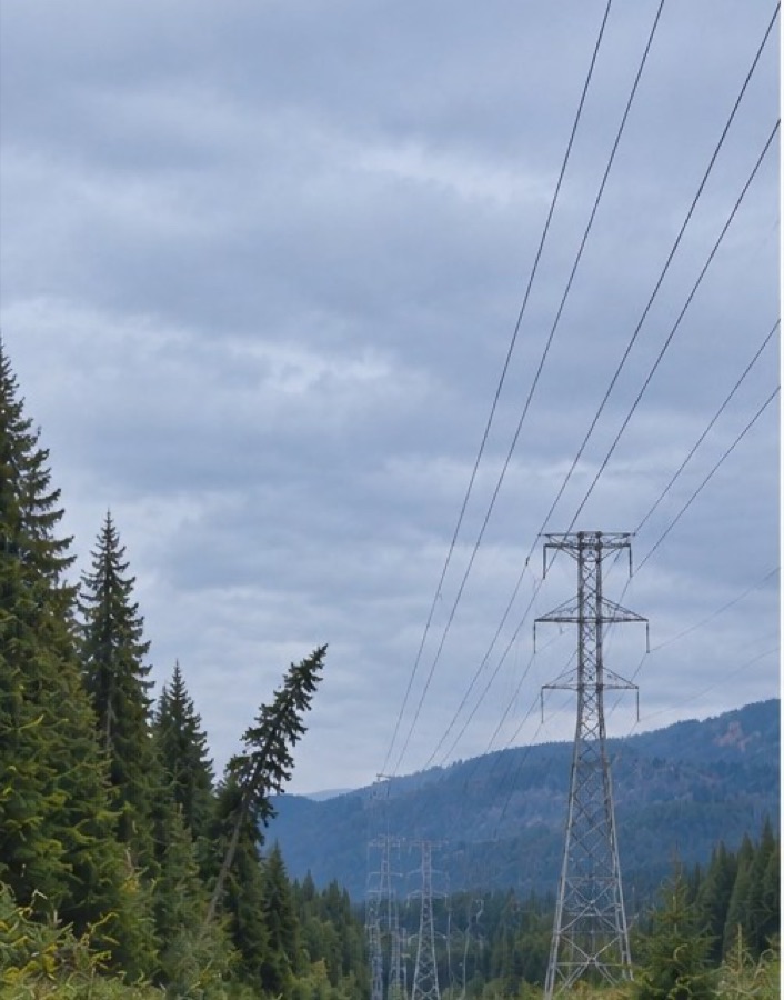
Slight lean toward the line. Nothing to do — but now it's a named thing with a question attached.
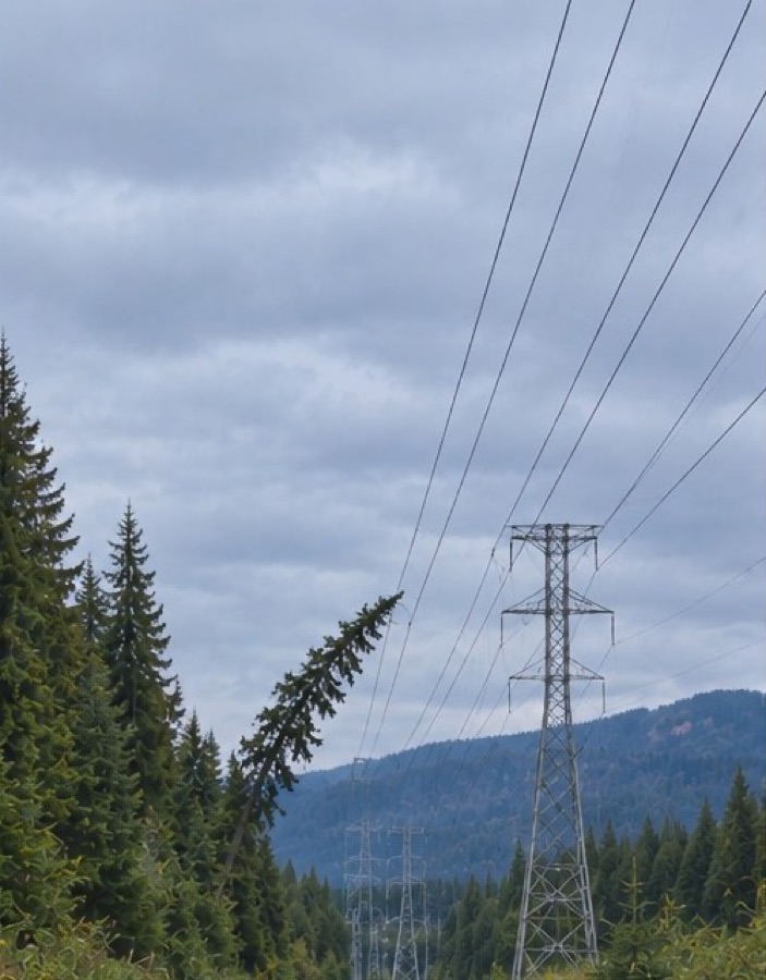
The lean has increased. An email goes out the day the record is published.
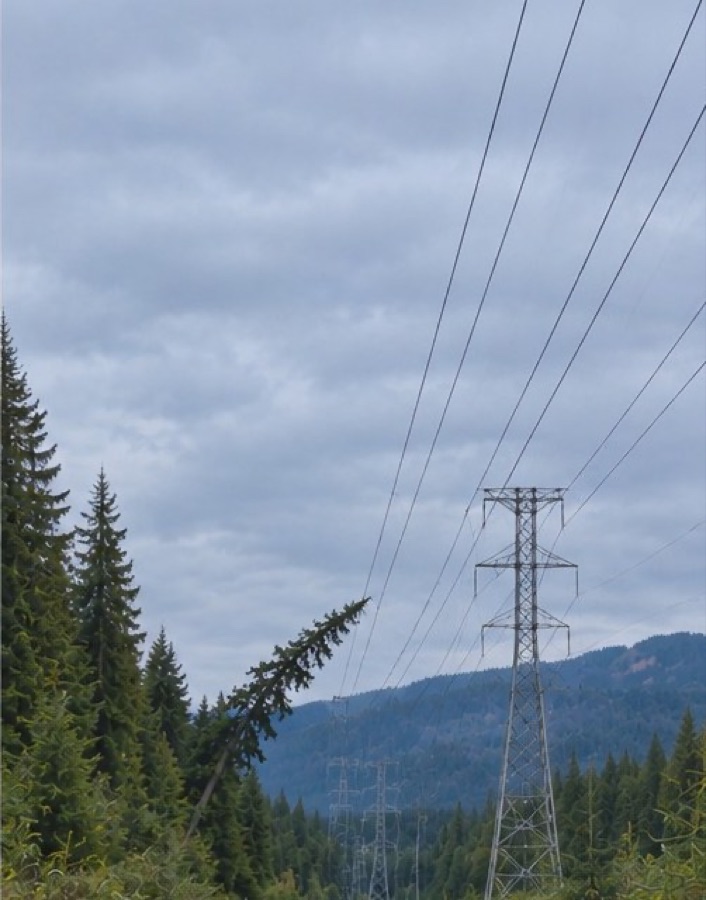
The crown has reached the line. This is now a crew and a date, not a discussion.
The three frames above are an illustration — a worked example of how a watch behaves over successive drives, not a captured record from a community's corridor. The box doesn't move. A watch is set on a place, and what changes is what stands inside it. Nobody walked this line — a vehicle drove past three times on scheduled passes, and the record did the noticing.
| Watch | Scope | Answers | Last event |
|---|---|---|---|
| Watch — Community egress route | ZoneMain access road · km 0–14 | Any point dropping two levels or more. | 15 Jul · fired |
| Watch — River bridge | AssetValley road · km 6.2 | Deck and approach condition each drive. | 15 Jul · quiet |
| Watch — Common washout zone | ZoneCanyon reach · km 8.5–9.7 | Standing water, a new washout flag, or an improvement of three levels or more. | 16 Jul · fired |
| Watch — Culvert at the creek | AssetUpper road · km 11.3 | Blockage, scour, or a change in the flow through it. | 15 Jul · quiet |
| Watch — Rock slide zone | ZoneBluff section · km 12.0–12.8 | New debris on the running surface after a storm or freeze-thaw. | quiet since Apr |
| Watch — Reclamation site, north pit | AssetHaul road · km 9.8 | Whether restoration has started, progressed or stalled since the last pass. | quiet since May |
Illustrative. In production, a fired watch emails the record's owner the day it's published.
A record of the territory nobody else has.
Pass after pass, season after season, every drive adds a dated, located layer: what the road was like, what the site looked like, what stood beside the route on that day. It builds into a time series of the territory, held in the Nation's name — one that no proponent, ministry or funder can produce for you, and none can dispute the date on.
Roads and trails are a good place to start — the drives are already happening. And it is not only the main routes: a trail your own people use, one that never sees a service truck or a ministry crew, is recorded the same way — dated, geolocated video of the route as it was on that day. Road-health scoring comes from the hitch-mounted sensor, so surface condition rides with the truck; the video record does not. But the record doesn’t have to start there, and it doesn’t stop there. Video alone, every drive, dated and located, is a record of the territory in its own right.
Your vehicles, your land, your record.
Your own people capture it
A capture kit in your own vehicles turns drives already happening into your records — trucks and trusted community members travelling your roads and trails, unlimited kilometres on one device. The skill stays in the community, and the record is built by the people who know the territory.
Or, we capture it
For remote territory, or when nobody is making the drive: we bring the driver and the kit, capture on your interval — monthly, quarterly, or per project — and hand the record over. It's the Nation's from the first pass. No subscription.
Either way it sits under one manager's signing authority, no procurement cycle. If your people are already on those routes, the kit is the way — the record and the capacity both stay home. If they aren't, we come to you.
Need funding? We work on it with you.
One kit and one driver covers a whole trail network — every road, route and access track your people already drive, on one device — and it is sized so a band office can start without a capital project. It also fits funding that already exists for this kind of work: non-structural mitigation, preparedness and community-held data. The Nation is the applicant. We work with your team and prepare most of the materials — the technical brief and the budget schedule — at no cost.
Emergency Management Assistance Program (EMAP)
Non-structural mitigation and preparedness — documenting whether the routes out are passable is the kind of work this stream is meant for.
First Nation Adapt Program
Assessing climate impacts on community infrastructure and emergency management.
Net Good Grants
Community-controlled digital infrastructure — the record held in the Nation's own name.
Indigenous Communities Fund
Smaller grants for Indigenous-led projects — the size of a first kit and a season of drives.
Programs, intake windows and eligibility rules change, and what qualifies depends on the community and the project. Ask us what's open before you plan around any of them.
What we don't claim.
Evidence. Long term. Verifiable.
Three layers from every pass — what was measured, what was filmed, what was said — dated, located and held in the Nation's name. Years later it can still be checked against the drive it came from, by anyone you choose to show it to. The earlier the record starts, the more it is worth: tell us which route you would document first.