 by IntelliMass
Remote Asset & Corridor Intelligence
Dated, geolocated visual records of the infrastructure you can't get to often enough.
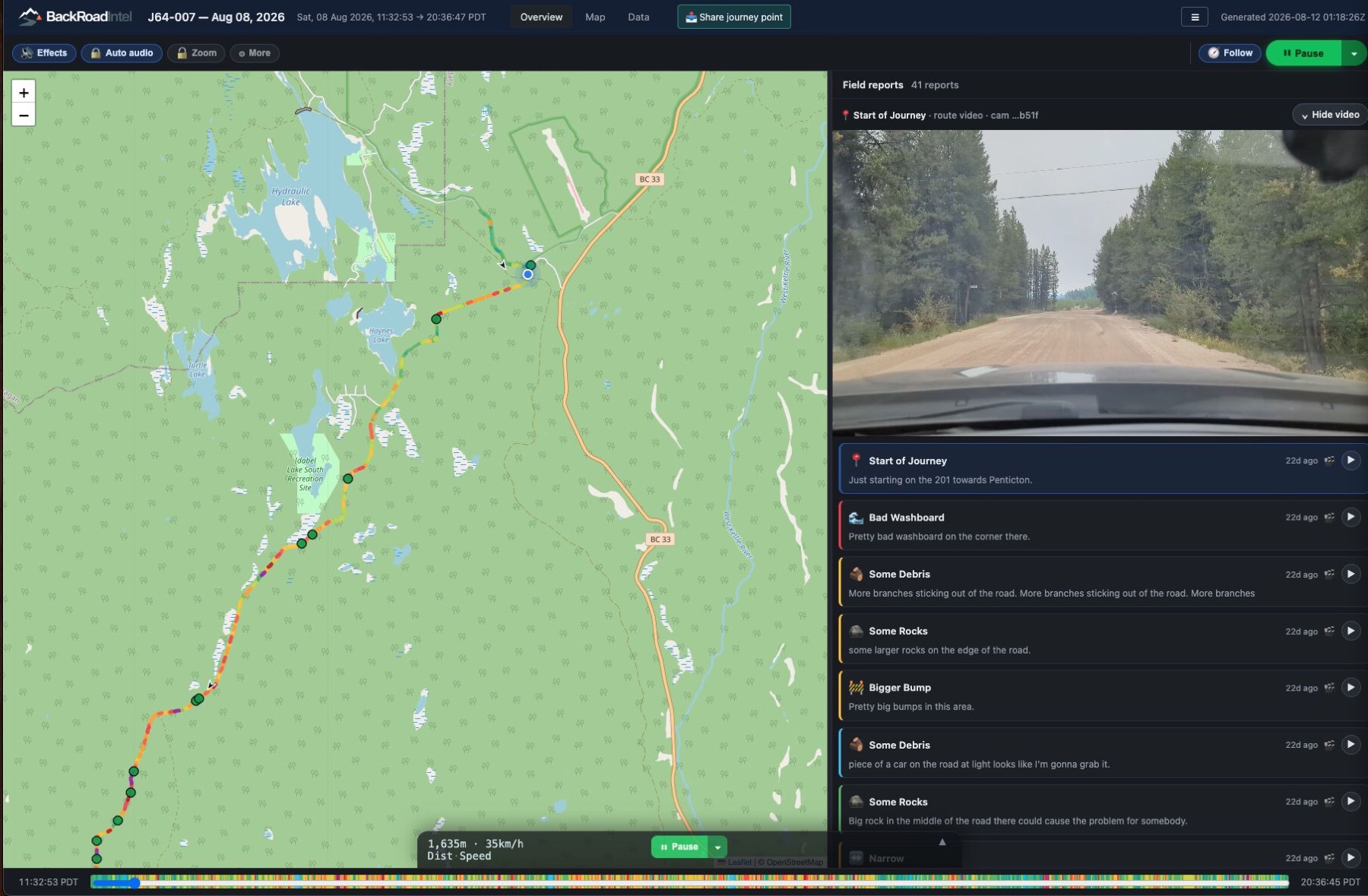
A vehicle drives the corridor. We turn that drive into a permanent record you can review from your desk, every point, every pass, compared over time.
Rights-of-way · access roads · haul roads · pipelines · perimeters · egress routes
You own more corridor than you can visit.
Inspection is mandatory. Rights-of-way, patrols, haul roads, dam access, the obligations exist whether or not the capacity does.
Contractors invoice; nobody verifies. Brushing, grading, clearing and repairs are proven by paperwork and a photo somebody chose to take.
The evidence question always comes. A regulator, an underwriter, a court or a council asks what you saw and when, and the answer lives in scattered field notes.
The same record. A different corridor.
Transmission corridor, pipeline corridor, access corridor, haul road corridor, the product doesn't change. The corridor type does. Open a sector for the full page.
Industry & energy
Private budgets, regulated inspection obligations, and contractors to verify.
Electrical utilitiesrights-of-way · access roads · stations
Know the condition of every right-of-way, access road and remote station you own.
Corridor programs are among your largest maintenance lines, and the evidence lives in scattered field notes.
Open the utilities page →Walk the entire line from your desk. Tower condition and ground condition at every point, not a sample at intervals.
The same coordinates before and after the cycle. Brushing, grading, culvert clearing and fence repair verified independently of the invoice.
Know the road is passable before the crew leaves, not after the truck turns around.
Encroachment, washouts, erosion and fence damage surfaced on your interval, not only at the annual inspection.
Visible encroaching growth is flagged for follow-up. Clearance measurement stays with your aerial and LiDAR programs, that's a claim we don't make.
Gas & pipelineROW patrols · crossings · encroachment
Your right-of-way patrols, permanently documented.
Patrols run weekly to monthly. The record is a paper form and a photo somebody chose to take.
Open the pipeline page →The whole ROW reviewable, not just the observation points someone stopped at.
Construction, excavation, staged equipment and ground disturbance in the right-of-way, on the record.
The conditions that change between passes, compared pass to pass.
GPS-tracked and timestamped, so the compliance file holds visual proof, not just a signature.
This strengthens your patrol documentation. We don't claim to satisfy a patrol requirement, that determination is yours and your regulator's.
Upstream & midstream energylease roads · wellsites · gathering lines
Know the condition of every lease road and site approach before the crew rolls.
Your access network is bigger than your inspection capacity.
Open the energy page →Passability, washouts, spring breakup damage and culverts, because a turned-back crew is a lost day.
Gathering lines and pipeline ROW, reviewable end to end.
Pads, gates, signage and fence lines at unmanned sites, captured on the drives already happening.
When you're proving a site was restored, a dated visual record is exactly what the file needs.
Mining & mineral extractionhaul roads · perimeters · TSF access
Every haul road, perimeter and access route, on one reviewable record.
You already inspect daily. Nothing keeps those inspections as something you can compare month over month.
Open the mining page →Surface, drainage, windrows and spillage, the same segment across dates, as it changes over days, weeks and months.
Long boundaries and multiple properties, covered on drives already happening.
Access roads, culverts, drains and visible erosion, on your weekly cadence.
Grading and road maintenance confirmed against the record, not the invoice.
A camera on a post sees one angle forever. A vehicle gets close to every section, at angles a fixed camera can't. Structural and geotechnical assessment stays with your engineers.
Public sector
Where evacuation routes and road health live, and where sponsorship can carry the cost when budgets can't.
Regional & county governmentsrural networks · road health · egress
A current condition record for every rural road you're responsible for.
Your network is measured in hundreds of kilometres and inspected by complaint.
Open the regional page →Surface, drainage, culverts and shoulders across the whole network, not just the segments someone reported.
Visible change between engineering inspections.
Dated evidence of what the condition actually was, which cuts both ways, and that's exactly why you want it.
A visual record of deterioration makes a stronger funding application than an estimate alone.
Regional road monitoring lives here. Evacuation & egress readiness is a dedicated program, see Emergency & evacuation.
First Nations communitiesterritory · egress · agreements · advocacy
Your territory's ground truth, held by the community.
A permanent record of conditions across your territory, roads, corridors, land, as they change over time. The community holds the record. Not the proponent, not the ministry.
Open the communities page →Whether the routes out are passable, documented before fire season, not during it.
Roads, corridors and infrastructure covered by impact-benefit or revenue-sharing agreements, verify condition without fielding a crew.
Condition records for the routes people depend on in high-risk terrain.
A dated visual record for funders, proponents and government tables, so the ask is documentation, not description.
This is where BackRoadIntel started, active deployments with communities across British Columbia.
Towns & municipalitiesroad health · contracts · egress
Your road network, on the record.
Open the municipal page →Surface and culvert condition across town, on a cadence.
Paving, patching and snow contracts confirmed against the record.
Evacuation route condition, documented ahead of the season.
Land & recreation
Smaller networks, mostly access and fence line, where the capture kit is usually the right fit.
Parks & resortsaccess roads · trails · seasonal opening
Access and trail corridors, season over season.
Open the parks page →What's passable now versus after melt, before guests and staff find out the hard way.
A dated record of trail and service corridor condition, compared year to year.
Fence lines and gates covered on drives already happening.
Private landownersranch & forestry roads · fence lines
Your roads, fences and gates, on a record you own.
Open the landowner page →Ranch and forestry roads, fence lines and gates, documented over time.
Dated proof of third-party damage on routes you share.
The same point on the corridor, three passes apart.
This is what an asset corridor record is: every point on the route, on every pass, comparable. Pick a pass.
PASS 1 / 2026-05-12 09:47 / KM 7.2
- Shoulder intact at culvert crossing. No flags on this segment.
Illustrative prototype. Production records open as hosted, view-only pages on a phone, no login.
A drive becomes a record.
A vehicle drives the corridor, continuous video, GPS and impact sensing, plus a tap to flag anything the driver sees.
We turn the drive into a reviewable record tied to the map, with conditions and hazards identified.
Scroll the corridor from your desk. Compare passes. Pull out the evidence you need.
Buy the record, or buy the kit.
We capture it
An asset corridor report, delivered on your interval, monthly, quarterly, or per project. Fixed price per corridor. No subscription, no ongoing obligation.
Fixed fee per corridor, quoted on length and interval
Your fleet captures it
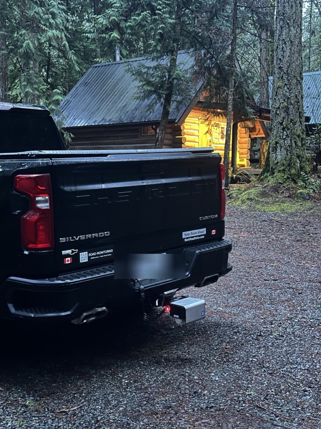
A capture kit rides in your own vehicles on drives already happening. Platform access turns those drives into your records.
$2,500 kit, first 30 days included
$1,000/month platform access
If you already have vehicles on those routes, the kit is cheaper. If you don't, don't build a program. Buy the record. Either way, it sits under one manager's signing authority: no procurement cycle.
Also from BackRoadIntel
Public-sector programs built on the same record.
Where evacuation routes and rural road health live. Regional road monitoring runs under the regional & county program; evacuation and egress readiness is a dedicated offering we're bringing back online.
The limits, out loud.
One pass is a snapshot. Repeated passes are a history, and history can't be recreated after the fact.
The earlier the record starts, the more it's worth. Tell us which corridor you'd document first.